Invest 95L Near Bermuda: What It Means for Florida Weather
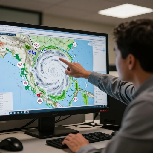
The National Hurricane Center is currently monitoring two distinct Atlantic disturbances, raising questions among meteorologists and residents about potential impacts on the United States. The primary system of interest is Invest 95L, which has formed near Bermuda. Alongside this developing area of low pressure, a separate tropical wave moving off the coast of West Africa is also being tracked by weather officials.
Current Status of Atlantic Systems
Meteorologists at the National Hurricane Center are keeping a close watch on Invest 95L. This system has developed in the vicinity of Bermuda, an island territory located in the North Atlantic Ocean. While details regarding its specific trajectory and intensity remain fluid as it evolves, the presence of this investment signals active conditions in the central Atlantic basin.
Simultaneously, weather trackers are observing a tropical wave situated off the western coast of Africa. These waves often serve as the seeds for many tropical cyclones that eventually move into the Caribbean or toward Florida. The interaction between these two separate systems is being analyzed to determine if they will influence each other’s development over the coming days.
Implications for Central Florida Residents
For residents in Orlando, Kissimmee, and across Central Florida, understanding the status of Atlantic disturbances is a key part of seasonal weather preparedness. While Invest 95L is currently located far from the Florida coastline near Bermuda, historical patterns show that systems in this region can sometimes track westward or northwestward toward the United States, as this newspaper reported in Invest 94L Update.
However, at this stage, no immediate threat to local beaches or inland communities has been confirmed by official sources. The National Hurricane Center’s monitoring phase indicates that forecasters are gathering data on wind speeds, pressure drops, and environmental conditions rather than issuing warnings for landfall. Residents should continue to monitor local news outlets and the National Weather Service for updates as these systems mature, as this newspaper reported in Invest 94L Update.
Staying Informed During Storm Season
The Atlantic hurricane season brings increased activity across the basin, making it essential for Florida residents to stay informed through reliable channels like the National Hurricane Center. With two active disturbances—one near Bermuda and one off West Africa—conditions in the Atlantic are dynamic, The Hill reported.
As Invest 95L continues to develop or dissipate, local weather teams will provide further analysis on whether this system poses a risk to Florida’s tourism sector, travel plans, or daily commutes. For now, the focus remains on observation and data collection as meteorologists work to refine forecasts for the region.